I initially thought this wouldn't be a very long walk - the path around the lagoon is largely wide and flat and you could easily bike around it or push a stroller. Roller skates would be a bit challenging towards the end when there is some up, but otherwise it would be a good skate too.
 There was a surprisingly large amount of bird life - gulls, grey herons, cormorants, stilts, tui, kingfisher, sparrows, thrush, blackbirds, and no doubt some I've forgotten. We saw a kingfisher pluck a crab from the mud (tide was out) and fly up to a try to crunch it up - then we noticed that the mud was teeming with the little crustaceans. They would stop moving whenever we tried to look closer, and had an annoying tendency to scurry around right at the periphery of your vision.
About a third of the way around the lagoon we got the to the Panmure Sailing Club and Nickname Pending decided it was time for a little surprise addition to our walk. We headed up a path to Ireland Rd, and proceeded along the street towards Waipuna Rd. At one point we delved into the imaginatively named Ireland Rd Treegrove, but this didn't afford the short cut NP was searching for, backing instead onto the railway line. So we headed back to the road, turned right at the end onto Waipuna, then right again onto the Mt Wellington Highway. We walked up this a fair way, past Coromandel Cacti, and ended up outside the carpark for Van Damm's Lagoon.
The sign and everything else put up by the council spells it Van Damm, but there's a plaque there from the local historic society which adds and e on the end. I'm going with the council 'cos surely they couldn't be that wrong?
This fresh water lagoon is artificial, built up from a local fresh water spring by the eponymous local who wanted to build a nature reserve for local bird-life. When the tannery between there and the Panmure Lagoon was shut down they gave some more land to the endeavour and eventually it came into council hands.
There are pretty little waterfalls at the start of the walk, and on the day we went it was very swampy. Parts of the path around the waterways and lagoon were boggy and flooded, but it was still interesting despite the mud. Quite an oasis in what is still a reasonably busy industrial area.
 While the only bird life we saw was of the duck variety, there was a wide range of flora, including both natives and exotic. There was a very impressive (as in tall) stand of bamboo at one end the lagoon, which you reached by going under a massive concrete pipe.
 Much of the path has been done up and there are signs that this work is still underway - new handrails in one area, freshly cut stone in another. I'd hate to go there at a time of year, or a time of day, when there would be a lot of insect life though - clearly a paradise for mosquitos and others who go the water larvae route.
  Then it was back out onto the Mt Wellington Highway, right along the Ellerslie Panmure Highway, and back down Ireland Rd to get back onto the path around the Panmure Basin. The exhaust fumes were really noticeable after even a short break away from the street.
We took up close to where we left off in our walk around the first lagoon, past mangroves, more mud flats and the buxus letters spelling out Panmure Basin on the lawn of Waipuna Lodge. Sadly the topiary letters are at just the wrong angle to really be able to read them unless you were above them by plane or helicopter.
Continuing on around the basin we came to the Auckland Model Engineers Society - they have a club house, a model boat pond, and an extensive small scale railway, complete with bridges, tunnels, stations, and the like. They weren't in action, but it looked like it would be fun to come back and watch, particularly with kids. Actually there were a lot of good things for children around the basin - in particular the fitness trail and two playgrounds (one of which, by the Sailing Club, looked really wonderful).
After all the flat, the slope up to the footbridge across the part of the lagoon where it meets the Tamaki River was a little bit of a surprise, but easily managed. The bridge itself is narrow and has a very low roof in the middle - tall people would have to be careful I suspect. We saw a decent sized fish jumping in the water below, as well as several cormorants diving for food.
 Then it was down hill back to the carpark and the end. Two hours in total, but I stopped a lot for photos. I think you could easily walk around the Panmure Lagoon in half an hour or so.
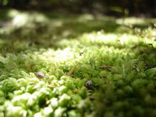
 The autumn trees were great, and there was some pretty cool moss and lichen, and even some actual mushrooms! I don't like to eat them, but I do like to snap them.


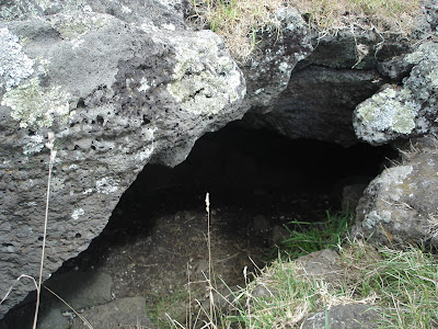
 I wanted to do this walk because I was curious about the waterfall. You have to go down some stairs to get to it, and the flat area at the bottom of the fall looks very beaten up, but the waterfall itself has a surprising impact. The pics don't really capture it I'm afraid.
 Above the waterfall there were ducks, and I did see a few other birds, but they were always flying away from me. A lot of people were using the path - walking, cycling, pushing strollers, exercising dogs. It'll be great when the path can sustain that use along its whole length.
 We took the walkway down to Ladies Bay and walked along the coast to Karaka Bay. This took quite a while, and originally we had intended just to walk back up the Ladies Bay walkway
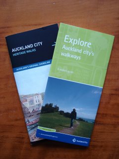
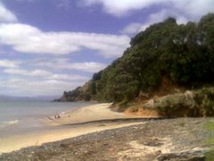
 and continue along the track in the handy leaflet from Auckland City Council. But we just seemed to keep walking. Once we were out of Ladies Bay itself it was very noticeable that there weren't any other women, although there were a fair few naked men. Oh I tell a lie, there was one woman. She was posing for top-less soft porn shots. I guess that's what happens in a nudist area. I didn't mind the nudity, but I didn't much like the stares from all the men.
 I love the shape of Motukorea, it looks as if it were lovingly sculpted by hand. Nickname Pending pointed out that it is quite reminiscent of
  We got a little bit lost at the end of Churchill Park but eventually found Glover Park, which is basically the crater of Whakamuhu with playing grounds in the middle. We walked up Waitara Rd and along the edge of the crater, looking back across the park to yet another water tower on the hills above St Heliers.


 We could see the geometric marker, but it took us quite a while to work out how to get there, as the trees are big, and thus mask much of the park.
 and stumbled across some very flighty goats and a single sheep. They insisted on either standing in the shade or running away (or both) so no snaps of them. There were cows too, but after
  At the top we could see the Otahuhu Power Station too (the two tall grey chimneys right in the centre of the photo).
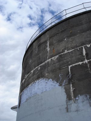
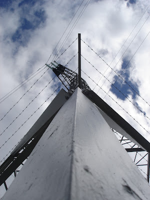
 We also discovered there was a water tower (a la
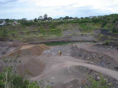
 Of all the ARC Parks we have visited so far this is the least visitor-friendly. It's clear that they have only been developing the non-farm aspects such as walks and native plantings since about 1998 or 1999, and there is little sign-posting of where to go from the entrance. We walked through some planting done in a previous quarry,
  and tried to get up to the peak of Hamblin's Hill (another water tower) but it wasn't obvious where to go, so we figured maybe you weren't meant to head up there just yet.
 Instead we took a walk down hill through reasonably new bush to the South Eastern Motorway. Again the lack of development was obvious, and at one point there was a signpost that took us off to a dead end. There was also a clearing at one point with a rusty water tank, an area fenced off for no apparent reason and a park bench.
 The shed at the start of the walk says there are tobacco plants throughout the bush, but sadly I don't know what they look like. It was a lovely walk through the bush, despite the lack of finishing, with some plants I certainly hadn't seen anywhere else.
 cattle
 (including one that wanted me to go away) ,
 and lots of nice (largely exotic) trees and long grass.

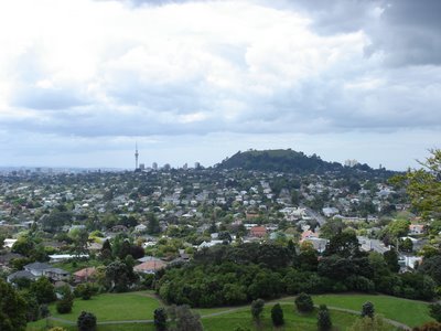
 We made it most of the way around in plenty of time, so decided to go up to the summit once we hit the west entrance road, as recommended in the book. We basically just followed the road up, along with many others, some of whom were disturbingly running and/or pushing baby buggies. Here's a pic of the summit, while walking up to it:
 And here's the obligatory child-running-around-the-plaque shot,
 Followed by the now mandatory tree's-eye-view(if-there-were-a-tree) pic