Showing posts with label North Shore walks. Show all posts

Saturday, January 06, 2007

Narrowneck to Milford Coastal Walk - 6th Jan. 2007

Yesterday's odyssey was undertaken with Homer, as Nickname Pending was at the cricket.

The Narrowneck, Takapuna and Milford coastal walk was down for three hours in the Day Walks of Greater Auckland book, but in fact it took us more like three and a half. Although there were some pauses for photos, sea glass and ice cream, we didn't stop enough to justify the extra half hour, so I suspect that the book did not include walking to the other end of Milford Beach, which we did because I used to sail from there.

We drove towards Devonport and turned off for Narrowneck, then parked in the large car park on the other side of the road from the beach reserve.
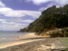
The path from Narrowneck to Takapuna beach is actually non-existent. You simply clamber around the rocks (if the tide is high-ish) or walk around the sand in a northly direction heading towards Milford. We started out at about 1.30pm and high tide had been at 10.15am. There was still quite a lot of awkward clambering, but on the return journey the tide had gone out considerably more and it was a comfortable walk along the sand in most places.

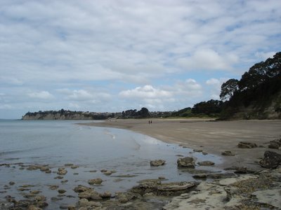
Once at Takapuna it's a matter of walking along the beach to the far end (where there's an ice cream shop) and then following the path around the coast to Milford. This path is sometimes concrete, sometimes shell, and even a wooden boardwalk at one point. There is some interesting lava, lots of lichen, and yesterday there was a good view (if you had binoculars) of the 470 World's, which was based at Takapuna Beach.
Here are some snaps:

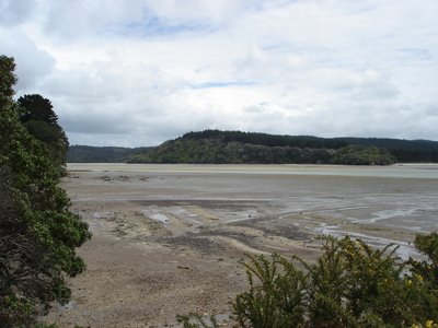
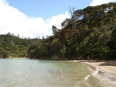
Looking back at Narrowneck from the rocks.

Cliffs between Narrowneck and Takapuna

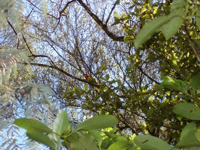
Cormorant with 470 fleet in background.
Some mysterious rusting metal between Narrowneck and Takapuna

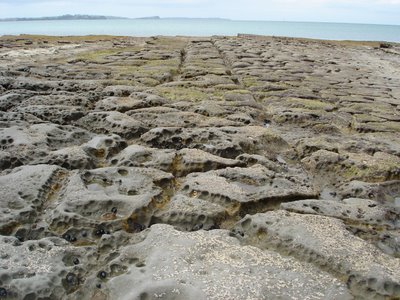
Typical shell and stone litter between the rocks.

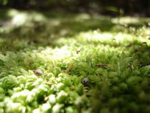
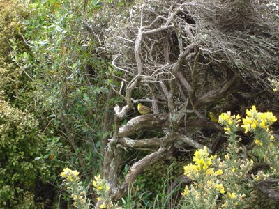
Moss on the rocks between Takapuna and Milford.

A sand pattern wot I liked, between Takapuna and Narrowneck.

A NZ-shaped rock formation Homer spotted.

Rangitoto from the sand.


All up a very pleasant meander, I recommend decent walking shoes or sandals and lots of sunscreen - even though it was cloudy and I had slapped I still got a bit burnt. While we walked from Narrowneck to Milford you could just as easily do it in reverse and there is probably more parking at the Milford end. Or you could just do bits of it, although apparently the Narrowneck to Takapuna part is impassable too close to high tide.

Friday, December 01, 2006

Perimeter Track, Wenderholm Regional Park - 2nd Dec. 2006

Today we headed north, along State Highway One, past Orewa, and then Waiwera, to sunny Wenderholm and it's Regional Park. As with Cascades Kauri Regional Park, the walks here are well organised - with a useful map at the start of the tracks which takes you through the options, including which are suitable for buggies (or not ok for jandals). The tracks are clearly sign-posted throughout, for the most part, and when it might get confusing, with a number of tracks converging, their are colour-coded posts to help. Big ups to the ARC.

We picked the Perimeter Track, recommended in our Day Walks of Auckland book. This involved a lot of up at the start, as we climbed Maungatauhoro, a former pa site. The tracks up included a lot of steps and boardwalks, as well as several well placed lookouts and a chance to see an old midden (which rather reminded me of why I found archaeology so boring at university).

The views from Maungatauhoro were great, and luckily the weather just got better as the day progressed.
The start of the Puhoi river, below:
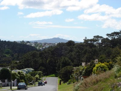
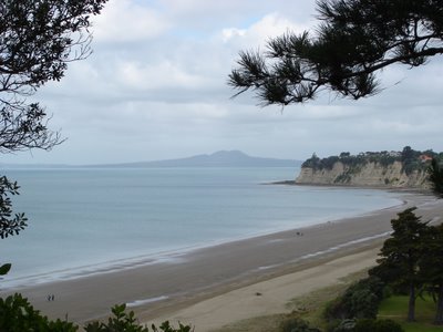
Looking east from the top:
Once you reach the top you can either walk back the way you came or take the tramping track down, which is largely unformed and would be very difficult in wet weather. We both had decent walking shoes so we headed down the tougher section, and the grips on my Tevas were indispensable.

Eventually we came out at Kokoru Bay, where in a former life I once cleared some bush (for reasons unknown) during one of those pointless weeks at the end of Sixth Form. Nice view across the river to Waiwera itself.

However the noise from State Highway One is pretty full on from about half-way down the hill until the track stops following the road and turns back into the park around half an hour later. At one point there was a whole gaggle of loud motorbikes heading across the Waiwera bridge, and even though we were a considerable distance away the noise reverberated around the bush and disturbed the peace.

The bush is not as regenerated as at Cascades Kauri, and I don't think I've ever seen so many nikaus in one place. Bird-wise we heard tui, saw piwakawaka (fantails), and of course blackbirds and thrush. My moss obsession continued.

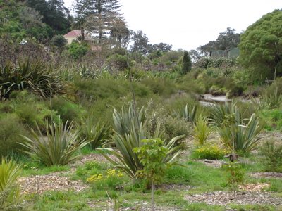
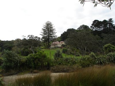
Almost the entire walk is through bush cover, until you start walking back to the carparks, along the road into the park itself. Here there are cows and sheep, not to mention a really large number of ducks. Before heading back to the car, after about an hour and a quarter of walking, we decided to have a quick squizz at Couldrey House.

Lovely spot, unfortunately it was $2 each to go in, which is fine except when you don't have any cash on you.

Then we decided to walk back to our vehicle along the beach. In a vain attempt to extend the tan on my feet beyond the patches my sandals expose I took my Tevas off, forgetting how hot the sand can get on a sunny day. The beach and picnic areas were being well used, and we spotted some oystercatchers on the sand, and of course the ubiquitous gulls.

Great set-up, interesting walk with information points along the way, definitely keen to come back and do some of the other tracks in the area, particularly the Puhoi walk which includes the pa area itself.

(Pictures added 7th Dec)

Friday, November 24, 2006

Devonport volcanoes - 25th Nov. 2006

This morning we headed over the bridge to Devonport and had a tasty brunch at The Stone Oven, just off the main road of "Devonport Village" as it is quaintly labelled in the map book. Then we lazily drove up the hill to the carpark, as far down as Mt Victoria as we could park, next to Devonport School.
The plan was to knock off three more volcanoes - Mt Victoria, Mt Cambria and North Head (Maungauika), walking between them and then back from North Head along the Devonport waterfront.

Mt Victoria has always been the poor cousin to North Head in my mind, in all those years I lived on the Shore - I thought it was shorter, it didn't have exciting tunnels, and it was too far from the water to attract my sea-spray soaked adolescent mind. I'd only been up Mt Vic once before, and had no real recollection of what was on the top. I believe I'd gone up by car rather than foot.

There's no clear track up, unless you follow the road to the summit, which we weren't keen to do. Luckily we spotted quite a few other people walking up on the grass so we just followed them and found there is a foot-created path that circles around and around the side, rather treacherous in places. The views going up, and on the top, were great:

Our next destination, North Head, from the top of Mt V:

On top of Mt Victoria is a weather station, and a field of airvents decorated as mushrooms. The weather station reminds me vaguely of the Empire's probe on Hoth.


There's also two quite cool bronze relief maps - one of quite a large area of the North Shore and Hauraki Gulf, the other just of the borough of Devonport. Below is a view of the city with the bronze Mt Vic in the foreground:

We then headed down Mt Victoria, following the road, then headed up Kerr Rd, along St Aubyn's, left down Church, and into the Mt Cambria Reserve. Most of the time we walked between Mt Victoria and North Head we seemed to be on the Walking School Bus route for Devonport School:
Mt Cambria isn't really a mountain, or even a hill. Maybe it was quarried away, there's certainly a lot of stone used in walls around the area. Whatever, it's really just a slight rise, topped by this lookout.
The reserve itself includes the Devonport Museum (which was closed) and the walks within it are well laid out although neglected.

Next we headed onwards towards North Head, crossing Vauxhall Reserve (cricket in progress), right along Cambridge Tce, through Devonport Domain (more cricket), left on Cheltenham Rd, then right up Takarunga Rd, to the entrance to Maungauika. I've come to the conclusion that Devonport is possibly one of the most English of Auckland's suburbs.

North Head has changed since the days I swarmed over it repeatedly as a child. Many of the tunnels I used to pursue have locked gates on them now, and I have a fear of the dark I didn't seem to be afflicted by in my early youth. Now the fences are down, and the summit is no longer the exclusive domain of the Navy. We walked right up to the top where there is a photo gallery and 15 minute video in the Stone Kitchen. The video is fantastic - it talks about the arrival of Maori in the region and the names they gave the hills in the area, then the use of the summits for military purposes from the fears of Russian invasion in the late 1890s through to the end of WWII. The top of Maungauika was a navy training site for many years, before being added to the rest of the park in the mid to late 1990s. The video includes a number of 3D animations of North Head and Fort Takapuna as they had been in previous times. Notably missing however was any record of how the hills went from being pa to settler military occupation.

We wombled around in the tunnels and gun turrets, although the camera crapped out again before long.

Then we headed down the side, and ended up walking the wrong way (because the path was washed out) around the coastal side of Maungauika, watching the yachts heeling in the strong wind. It didn't take long to get back around to the Cheltenham side of the hill, then head along King Edward Parade and back to Victoria Rd in the heart of the village for our ice cream reward.
All up this was an interesting walk - the hills provided plenty of up but the views distracted from any difficulty. Only the track on Mt Victoria was difficult to navigate in parts, and you could just go up the road and stairs instead. A varied walk, covering hills, streets with lovely old and new houses, some flat (or nearly flat) parks, and a coastal part too.


Saturday, November 11, 2006

Writers' Walks

Googling around (aka procrastinating) found this link to NZ's Writers' Walks and other literary "destinations". The Auckland ones seem to all be on the North Shore.

Could be a useful resource if we run out of volcanoes or walks in the Day Walks of Greater Auckland book, although I don't see that happening anytime soon...

Saturday, October 28, 2006

Kauri Point Centennial Park - 28th Oct. 2006

Yesterday Ferd and I walked along several of the tracks at Kauri Point Centennial Park, from the lower entrance on Onetaunga Rd in Chatswood, on the North Shore.

And here is the view going in via said lower entrance:


Most of the walks were through the bush and, except for the track from the main entrance to Kendalls Bay (Rongohau), the tracks weren't very well maintained - clearly lots of bits that had worn away through weather and use. As a result the track could be quite difficult to maneouvure when it's not dry.
Despite the name of the park there weren't many kauri in evidence, certainly no adult ones. It's an area dominated by old pines, although the bush that is re-generating is largely native and there's clearly an ongoing intention to whittle out some of the larger pines to encourage this, as there were a lot of massive pine trunks cut and left on the forest floor.


One track that we followed went out to a point where you could see the Chelsea Sugar Factory, the Harbour Bridge and across the inner Waitemata which was quite lovely but the trees obscured the view. From here you can walk all the walk to Chelsea, but we headed for Kauri Point itself and Rongohau instead.

There was an unofficial track out to the end of Kauri Point, branching off where the main track heads down hill to the eastern part of Rongohau. The views from out there were just grand:

And there was some lovely moss along both sides of the path at several points:


Bird-wise many were heard but few seen. I suspect as this is very close to an urban area the birds are quite reticent. There did seem to be a small flock of escaped parakeets, which followed us around a bit, but still didn't come very close. We also saw a tui and a pair of fantails very briefly flit past.


Kendalls Bay itself was accesible from the eastern end and the western end, but as the tide was in you couldn't walk between them unless you went back inland via bush and hills (which we did). A very lovely spot, only two other people on the beach although we did see quite a few people walking their dogs up on the tracks.

Eastern end:


At this point the camera crapped out again so I turned to my mobile. But I think I've since worked out how to fix it whenever it does it, so mercifully I won't be having to rely on the phone camera again, fingers crossed.
Western end:


This walk took us about 2 hours, with quite a bit of stopping for photos and a sit-down break in the western part of Rongohau for a snack. Although it's a bush area it's quite different from the traditional NZ bush walk, due to the high presence of pines rather than natives. Quite a bit of up and down, and the track itself would be a challenge in places if you had weak ankles or short legs. Would definitely like to go back and do the loop walk through the swamp, and the track to Chelsea, that we didn't have time for.

Thursday, October 26, 2006

North Shore Council walks

Sussing out the Le Roy's Bush walk to do tomorrow with Ferd (weather permitting) I found the North Shore City Council's page on walks and popular parks.

Friday, October 20, 2006

Long Bay Coastal Walk - 21 Oct. 2006

Today we headed north, to the far end of Beach Rd, where Long Bay Regional Park begins. Although I'd been to the beach and the area close to it many many times in years gone by, I'd never actually ventured past there and along the Long Bay Coastal Walk.

We started out by heading along a short Nature Trail which was interesting but would have benefited from a few labels on the trees as there were quite a few intriguing specimens that I have no idea about.


Then we walked up to the Vaughan Homestead, which weirdly faces in, across the river, rather than out to the great views of Rangitoto. The start of the Coastal Walk turned out to be at the bottom of this hill, so we squelched back down and then headed up along the cliff tops towards the mouth of the Okura River.


Many birds were spotted, some of unknown name, but including grey herons, several types of gull, cormorant, magpies, fantails, sparrows, thrush, blackbirds, tomtits, finches, pukeko, ducks, and something that may have been a yellowhammer?


Walking around the clifftops involved quite a lot of up hill and down dale, but the views were grand,

and eventually we made it to the Okura River mouth, to start the trek back around the coast (which is only passable three hours either side of low tide).

The walk back seemed a bit dull at first - impressive sedimentary layer cliffs to the right, views of Whangaparaoa Peninsula to the left, rock and sand underfoot. But after a while I started to notice the large range of rock formations, some of which were quite like the surface of another planet (or how I imagine the surface of another planet, to be more accurate).


All in all a lovely walk, took us about 3 hours in total, involving a great deal of stopping for photos, and a really rather nice view of Long Bay at the end.