Once you get to the camping ground by Lake Tarawera, it's a simple matter of walking over the new wooden bridge (which has replaced the swing bridge referred to in the Walks in the Rotorua Lakes area leaflet we bought from the Rotorua Information Centre). Then you can pick the walk left to Humphrey's Bay and ultimately meet up with the Lake Okataina tracks, or you can turn right, as we did, to the Tarawera Falls.
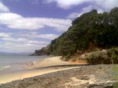
The Tarawera Outlet is where the river from the lake to the falls begins. It's a typical NZ freshwater estuary, complete with children jumping off the bridge when we were there.
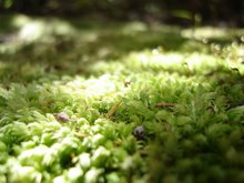
 The walk partly follows the river as it heads towards the falls, but wends away at times. Much of the bush has regenerated since the 1886 explosion of Tarawera, and there are massive rocks strewn through the surrounds - often with trees now growing around or through them. It gives you a sense of the power of the eruption to see these huge boulders thrown so far from the mountain. In places the ground is totally overgrown with odd little plants and mosses, in others ferns predominate. The bush here was not like in the Greater Auckland area - few kauri, no nikaus, mostly pohutukawa, rata, and other trees I wasn't familiar with. While we heard a lot of birdsong none came close enough to see or snap.
The track also goes through a particularly alien landscape at one point. Most of the time it's all reasonably typical native bush for this part of the country, but then you end up in this higher area, where it's all scrubby manuka, much of it covered in black moss. Perhaps a part of the land particularly scarred by the eruption.
The river itself has a number of minor waterfalls along it,
 and also a very inviting water hole, complete with several rope swings. Very tranquil and restful.
Other parts are reasonably wild, and at several points various parts of the river plunge down into the rock and disappear underground,
 Ultimately we ended up at Tarawera Falls, where the river spurts out of the cliffs. There's a cobbled area there with a few benches and we stopped to have a picnic before heading back.
  It took us about an hour and a half to get to the falls, stopping a lot for photos. On the way back it started to rain a little so we pushed the pace a bit and made it the whole way back in only an hour. The signs (and leaflet) say two hours each way, and there is quite a bit of up (some with stairs) but mostly it's a gentle slope down on the way to the falls, and obviously the reverse on the way back. I would also advise wearing closed shoes. The track is maintained through small stones which are really annoying if you are wearing sandals, even decent ones like Tevas.
If you wanted to see the falls but didn't want to walk so far you can also access them through a 20 minute walk from Waterfall Road, where there is a carpark and toilets apparently. But that would be cheating.


1 comment:
Thank you for your wonderful blog. I have referred to it in a handout I am going to give to people registered to go on the Tarawera Falls walk as part of the Rotorua walking festival 2011. any profit from running the walk is going to Rotorua Hospice and to the Christchurch earthquake Fund. Thank you for your concise descriptive writing and great photos.
Post a Comment