Yesterday we drove out along the
North-Western Motorway, got off at
Lincoln Rd, then headed through
Swanson and
Ranui (old leafleting haunts both) to
Scenic Dr and
the Waitakeres.
We did the
Dam walk first, which leaves from a carpark on Scenic Dr, handily festooned with a
Waitakere Dam Carpark sign. Other signs however were misleading. One said it would take 1 and a quarter hours to get to the dam from the carpark. It took us only about half an hour, following the road down the hill. It's quite a boring walk there really, although we took two short bush diversions - one to a large kauri just off the road, the other was a track than ran below the road for a few minutes with some great views towards the
Cascades Golf Course, which we had seen when we did the
Auckland City Walk a while back.
Here's the typical view walking along the road to the dam.
The dam itself is quite spectacular, much bigger than I'd expected. There is a noticeboard explaining some of the history of the dam, the tramline, and of course the vital pipeline that carries the water from the reservoir to the city.
The dam from the hill wot you walk down to get to it.

Looking up at the dam from beneath.

There are nice toilets (longdrops of course) and there's a little section of bush below the damn, with some beautiful tui - it's strange seeing them from above and noticing the beautiful teal plummage that we miss from our usual vantage point.
Then we walked back up the hill a little to the start of the Tramline Walk. It doesn't follow the tramline the whole way, as it is too dangerous near the dam itself due to a fragile cliff face. But it was a pleasant and interesting walk including:
Looking back along the track, and the pipeline

A narrow but very high waterfall you walk under:
The first, short, tunnel, going in:

The Tramline Society's mini train - stopped at
Picnic Flats when we came across it.
And the second tunnel, which is closed off and apparently quite long (with glowworms!).

It marks the end of the Tramline track and from there you can either turn around and go back to the Dam track to get out, or head along the
West Tunnel track. We chose the latter.
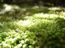
Which turned out to be a grand decision, because not only was there cool moss,

there was also impressive fungi.


The West Tunnel track was pretty muddy in parts, and at one point, where we had to cross a stream, it was very difficult to work out where the track went next. There's evidence that the ARC is starting to put boardwalks through, but the work is only just begun and at the moment the track is quite a challenge in parts.
Eventually we met the Anderson Track and turned along that towards Scenic Dr. All well and good until we got to a fork in the track...

In the end we just picked one, no science to it. It took longer than 5 minutes to get there, but we did end up out on Scenic Dr. Unfortunately there was no indication of the direction of the carpark from the bush exit, so again we picked a direction and walked along the road, until we established that we had gone the wrong way, then we walked all the way back to our starting point, and then about another twenty minutes further to the car.
All up I think we walked for about two and a half hours. It would have been just over two without the mistake at the end. The walk to the dam is easy going down, but would be a bit of a puff coming back. The tramline walk is great, but the way out from there is soggy and difficult in parts. Once the boardwalking is complete it will be fantastic.


 The Tramline Society's mini train - stopped at Picnic Flats when we came across it.


 The West Tunnel track was pretty muddy in parts, and at one point, where we had to cross a stream, it was very difficult to work out where the track went next. There's evidence that the ARC is starting to put boardwalks through, but the work is only just begun and at the moment the track is quite a challenge in parts.


No comments:
Post a Comment