Then it was down, beneath the level of the road, and along the Oakley Creek Walkway. Billed in a City Council brochure as containing the isthmus' only natural waterfall, it's obviously undergoing significant renewal. This is good because the path and the park are in a parlous state at the moment, although the work already done is making a big difference. It will be a fantastic oasis when it's finished.
Most of the trees are exotic, but the planting programme appears to be largely native, so eventually there will be a good mix. The path kind of follows the creek - at parts it is quite a distance from it, but in general it winds back and forth across it via some pretty bridges.
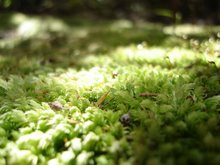
 The autumn trees were great, and there was some pretty cool moss and lichen, and even some actual mushrooms! I don't like to eat them, but I do like to snap them.


There are also some curious old walls throughout the park, possibly put in when Unitec was Carrington, and Carrington was a mental institution?
 I wanted to do this walk because I was curious about the waterfall. You have to go down some stairs to get to it, and the flat area at the bottom of the fall looks very beaten up, but the waterfall itself has a surprising impact. The pics don't really capture it I'm afraid.
 Above the waterfall there were ducks, and I did see a few other birds, but they were always flying away from me. A lot of people were using the path - walking, cycling, pushing strollers, exercising dogs. It'll be great when the path can sustain that use along its whole length.
I wanted to do this walk because I was curious about the waterfall. You have to go down some stairs to get to it, and the flat area at the bottom of the fall looks very beaten up, but the waterfall itself has a surprising impact. The pics don't really capture it I'm afraid.Above the waterfall there were ducks, and I did see a few other birds, but they were always flying away from me. A lot of people were using the path - walking, cycling, pushing strollers, exercising dogs. It'll be great when the path can sustain that use along its whole length.Walking to the end and back would take around an hour. The concrete path is broken in parts, and narrow the whole way, but this is a very pretty and serene walk. It does need more signage though - there were a lot of paths off to the side, which I suspect joined up with Unitec of the housing on the road-side of the creek, but it wasn't clear, particularly at the end. I'm still not sure I walked the whole way.

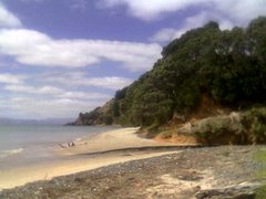
 We took the walkway down to Ladies Bay and walked along the coast to Karaka Bay. This took quite a while, and originally we had intended just to walk back up the Ladies Bay walkway
 and continue along the track in the handy leaflet from Auckland City Council. But we just seemed to keep walking. Once we were out of Ladies Bay itself it was very noticeable that there weren't any other women, although there were a fair few naked men. Oh I tell a lie, there was one woman. She was posing for top-less soft porn shots. I guess that's what happens in a nudist area. I didn't mind the nudity, but I didn't much like the stares from all the men.
 I love the shape of Motukorea, it looks as if it were lovingly sculpted by hand. Nickname Pending pointed out that it is quite reminiscent of
  We got a little bit lost at the end of Churchill Park but eventually found Glover Park, which is basically the crater of Whakamuhu with playing grounds in the middle. We walked up Waitara Rd and along the edge of the crater, looking back across the park to yet another water tower on the hills above St Heliers.

 Once the creek meets the Tamaki River, you have a great view of Mt Wellington (my new nemesis now that
  The tide was a long way out, as you can see from the pics, and it took us over an hour to get to the Pakuranga Plaza end of the walk. We turned around and came back, stopping in a bay to eat our packed lunch, and generally watched the windsurfers on the water and the families on the pathway. There were a lot of bikers, and they are supposed to give way to pedestrians. Most do.



 We headed along to the base of the falls first, although this wasn't actually on the walk we were doing, and also ventured to the Lower Falls Lookout. We tried to go to the Upper Falls Lookout but the track was poorly signed and we ended up on the Massey Track instead. Unfortunately we didn't know this and went back down the Massey Track when we needed to go up it.
 We sorted it out reasonably quickly, but this was really a bad sign for what was to be quite a bad walk.
 Again the lack of good signage was frustrating. We kept walking around the reservoir and in the end took a bit of a punt on which way to go as there were no signs. Luckily we were right.
 The Cossey Gorge Track was more gentle, although still satisfyingly rugged, including crossing a stony river bed (which wasn't too much of a hassle after
  Plus I felt much better for coming across two friendly German Shepherds and their walkers.