The plan was to knock off three more volcanoes - Mt Victoria, Mt Cambria and North Head (Maungauika), walking between them and then back from North Head along the Devonport waterfront.
Mt Victoria has always been the poor cousin to North Head in my mind, in all those years I lived on the Shore - I thought it was shorter, it didn't have exciting tunnels, and it was too far from the water to attract my sea-spray soaked adolescent mind. I'd only been up Mt Vic once before, and had no real recollection of what was on the top. I believe I'd gone up by car rather than foot.
There's no clear track up, unless you follow the road to the summit, which we weren't keen to do. Luckily we spotted quite a few other people walking up on the grass so we just followed them and found there is a foot-created path that circles around and around the side, rather treacherous in places. The views going up, and on the top, were great:

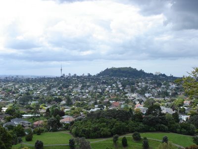
Our next destination, North Head, from the top of Mt V:
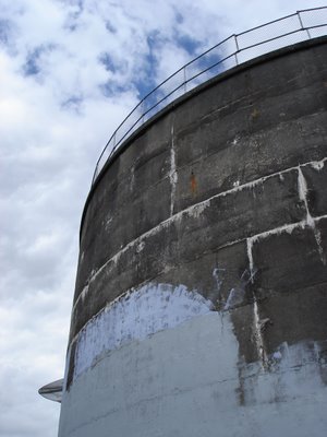
 On top of Mt Victoria is a weather station, and a field of airvents decorated as mushrooms. The weather station reminds me vaguely of the Empire's probe on Hoth.

 We then headed down Mt Victoria, following the road, then headed up Kerr Rd, along St Aubyn's, left down Church, and into the Mt Cambria Reserve. Most of the time we walked between Mt Victoria and North Head we seemed to be on the Walking School Bus route for Devonport School:
 Mt Cambria isn't really a mountain, or even a hill. Maybe it was quarried away, there's certainly a lot of stone used in walls around the area. Whatever, it's really just a slight rise, topped by this lookout.
 The reserve itself includes the Devonport Museum (which was closed) and the walks within it are well laid out although neglected.
Next we headed onwards towards North Head, crossing Vauxhall Reserve (cricket in progress), right along Cambridge Tce, through Devonport Domain (more cricket), left on Cheltenham Rd, then right up Takarunga Rd, to the entrance to Maungauika. I've come to the conclusion that Devonport is possibly one of the most English of Auckland's suburbs.
North Head has changed since the days I swarmed over it repeatedly as a child. Many of the tunnels I used to pursue have locked gates on them now, and I have a fear of the dark I didn't seem to be afflicted by in my early youth. Now the fences are down, and the summit is no longer the exclusive domain of the Navy. We walked right up to the top where there is a photo gallery and 15 minute video in the Stone Kitchen. The video is fantastic - it talks about the arrival of Maori in the region and the names they gave the hills in the area, then the use of the summits for military purposes from the fears of Russian invasion in the late 1890s through to the end of WWII. The top of Maungauika was a navy training site for many years, before being added to the rest of the park in the mid to late 1990s. The video includes a number of 3D animations of North Head and Fort Takapuna as they had been in previous times. Notably missing however was any record of how the hills went from being pa to settler military occupation.
We wombled around in the tunnels and gun turrets, although the camera crapped out again before long.

Then we headed down the side, and ended up walking the wrong way (because the path was washed out) around the coastal side of Maungauika, watching the yachts heeling in the strong wind. It didn't take long to get back around to the Cheltenham side of the hill, then head along King Edward Parade and back to Victoria Rd in the heart of the village for our ice cream reward.
All up this was an interesting walk - the hills provided plenty of up but the views distracted from any difficulty. Only the track on Mt Victoria was difficult to navigate in parts, and you could just go up the road and stairs instead. A varied walk, covering hills, streets with lovely old and new houses, some flat (or nearly flat) parks, and a coastal part too.
 Then it was into the bush. Near the start of the walk we crossed a small river by wire suspension bridge.
  Then we generally wandered our way along the track, taking a few more pics along the way.
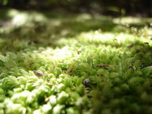
 Mostly of moss. I seemed to have rather the moss obsession today. But I'll only put up my favourite.
 After a while there's a short track you can take to the falls themselves. Now we'd been pre-warned by the book that there wasn't much to see. It was a nice walk, with some really quite spectacular rock formations and overhangs (which didn't photograph well). But yes there was some disappointment at the end. Here's the view of the falls from the end of the track.
 If you squint you can just make out a little white bit in the middle of the shot. That's water rushing past.
 Then it was back to the main track.